
Another interesting project from our power user @swf from Swiss Web Factory
Here’s the description he kindly provided:
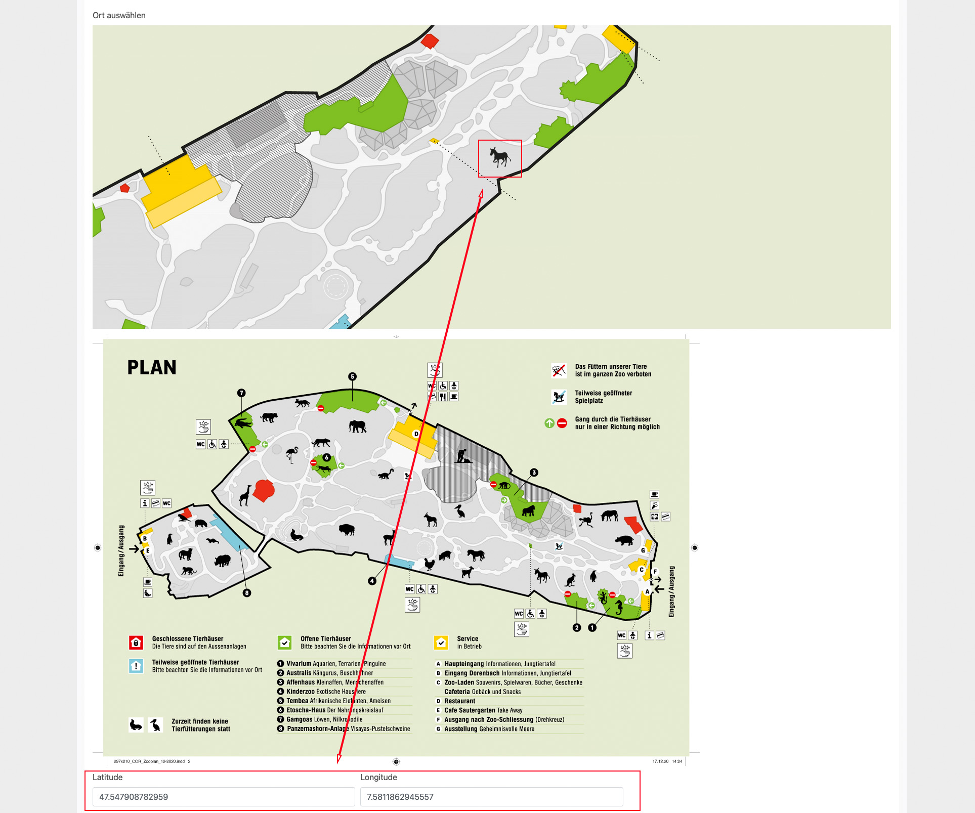
For Basel Zoo we have implemented an interactive zoo map that is identical to the printed one handed out at the zoo. To do this, we put a graphic overlay on Google Map with MapTiler. All destinations are provided with geospatial data and are thus displayed in real positions. The zoo visitor can have his position displayed on the map on site.
The pins are displayed as individual icons in different categories and can be filtered according to these (e.g. to only display the animals). Individual locations can also be selected directly. The map then moves to the destination and the animated icon helps the visitor to find it on the map. The map can be zoomed in and out by the visitor.
The data is controlled by a database and can therefore be flexibly adapted. All adjustments can be made in the CMS.

In order to facilitate the positioning of the icons, we have also implemented the map in the CMS and linked the input of the geographic coordinates with the positioning of the icon. These are updated by dragging the icon.
Last updated: